We continue to tell you about the main tool of visualization and analytics data – the report designer. In the last article, you learned about the Gauge element. Now, it’s time to consider the next dashboard element – Online map.
For example, you want to display all car dealers in Europe. At the same time, you’d like to specify separate geographic objects, designate them with some icons and define their color, add them a certain color and specify the number of sold cars in each country.
The Online map element will assist you to make it. To do this, you should correctly apply three modes of the element. This is what we’re going to tell you about.
Online map
This element allows you to display any geographic object on the bing online map. It includes 3 modes of work - Location, Latitude, Longitude, and GIS.For example, you want to display all car dealers in Europe. At the same time, you’d like to specify separate geographic objects, designate them with some icons and define their color, add them a certain color and specify the number of sold cars in each country.
The Online map element will assist you to make it. To do this, you should correctly apply three modes of the element. This is what we’re going to tell you about.
Location
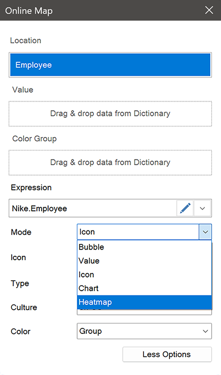
This mode allows you to specify data fields with positions of geographic objects. You can specify the name of a country, city, region, etc. Besides, you can display your data, for example, the number of car dealers as charts, bubbles, or just numbers. To do this, you should select the display mode of values. Here are five of them:- Value;
- Chart;
- Bubble;
- Icon;
- Heatmap.
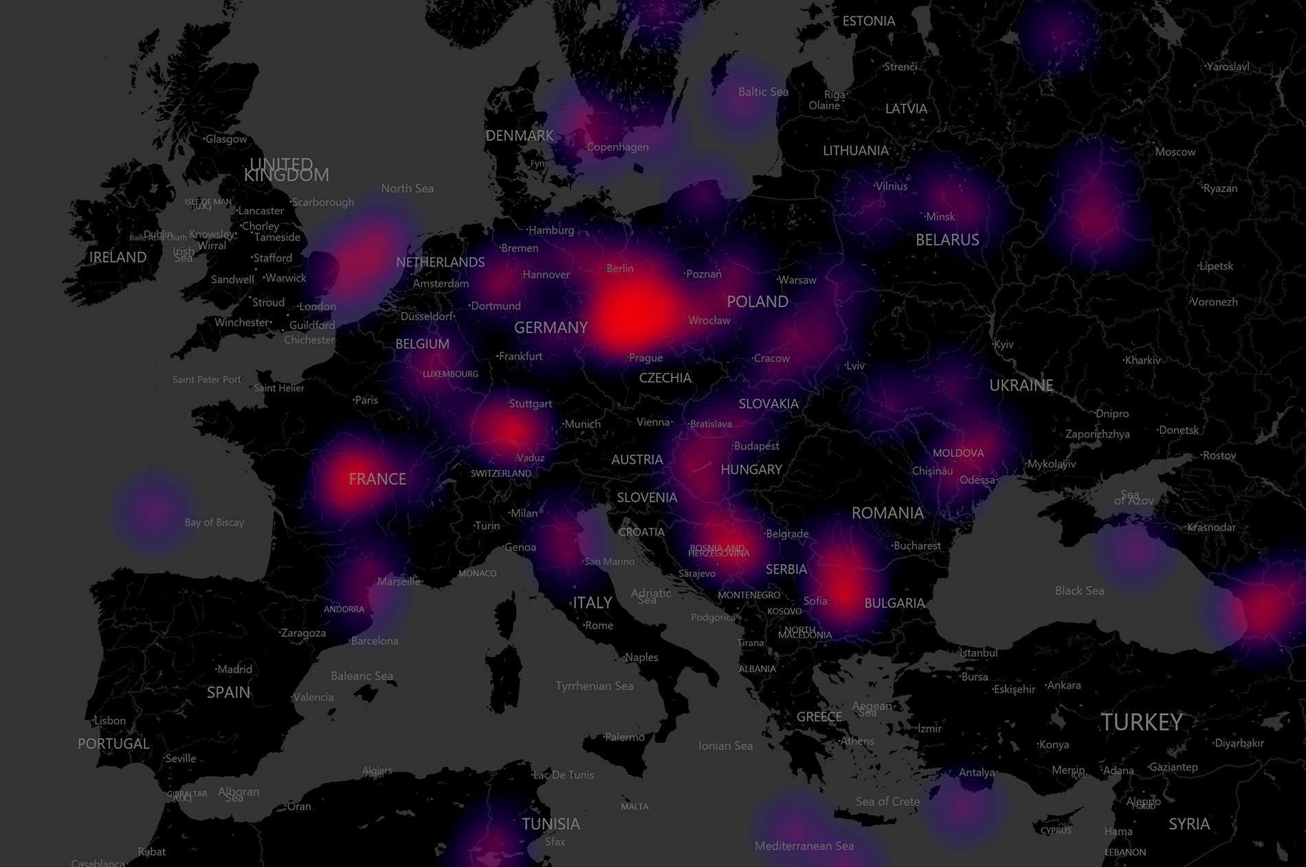
You should especially take note of the Heatmap mode. It can be used to highlight the largest and smallest values of geographic objects. On the map of Europe, the country with the largest number of car dealers will be highlighted with one color (brighter), and those countries where there are less of them with another color (dimmer). Thus, it is possible to show the number of car dealers in each country visually.
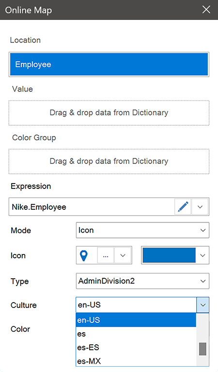
In addition, this mode allows you to select a culture.
In other words, you can select a localization language for your map. To do this, you should select a suitable item from the list (in the example en-us was selected, i.e English (United States), and all geographic objects will be displayed in a language of a selected culture. The list of cultures is quite wide and includes several dozens of localization variants of map objects.
In other words, you can select a localization language for your map. To do this, you should select a suitable item from the list (in the example en-us was selected, i.e English (United States), and all geographic objects will be displayed in a language of a selected culture. The list of cultures is quite wide and includes several dozens of localization variants of map objects.
Latitude and Longitude
This mode allows you to display the geographic position of an object on a map. Let's take the case of car dealers where we need to display all of them on the map of Europe. To do this, you should just specify their latitude and longitude, and they will be shown on the map.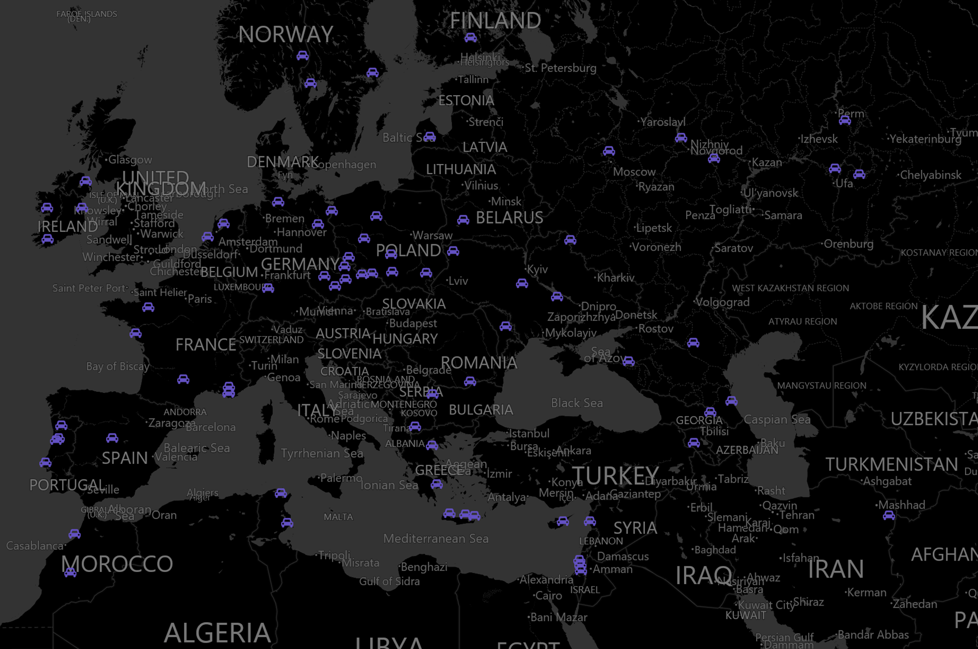
In addition, you can display your data and geographic objects in different ways just like in the Location mode. Unlike the Location mode, here it’s possible to use only Icon and Heatmap.
GIS mode
If you want to show separate geometric objects on a map, you should use the GIS mode. Objects are drawn using points, lines, and polygons.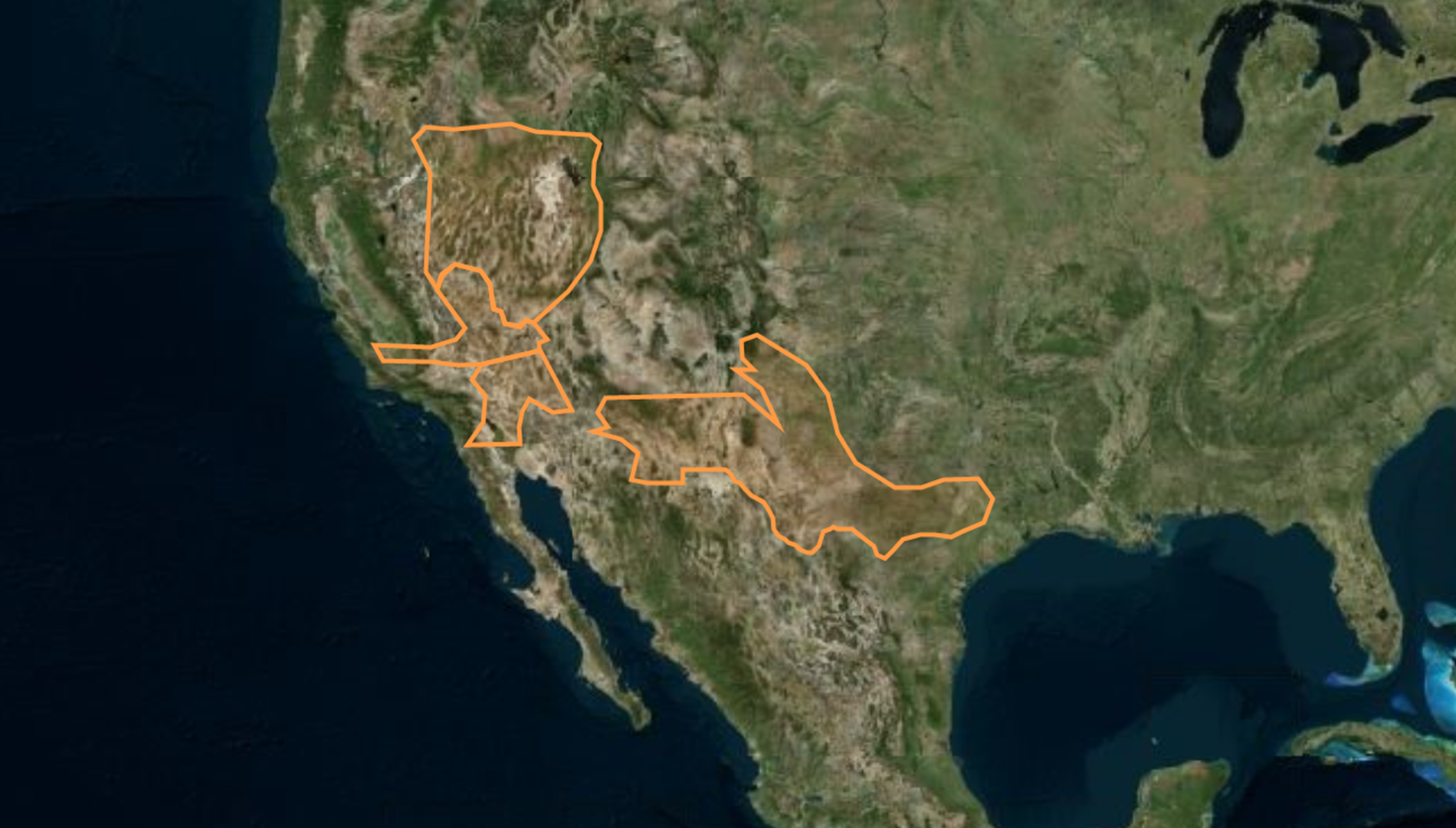
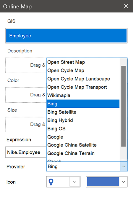
In turn, in this mode in the Provider point you can select a map type that you need. It's worth noting that the choice here is quite wide - among the types available by default you will find:
- Open Street Map;
- Wikimapia;
- Bing;
- Google and more.
Examples of using the Online map element
So, let’s take a look at several dashboards in which the element is used.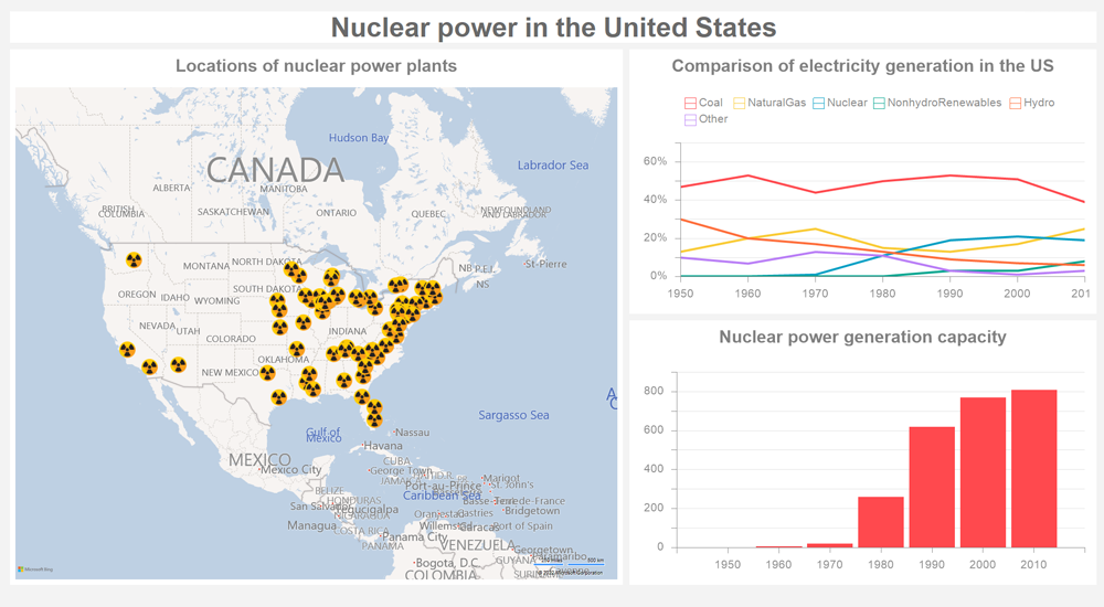
Nuclear power in the United States
The dashboard shows nuclear power stations of the USA and a comparison of electricity production and growth of nuclear power capacity of this country over the last 60 years. Due to this dashboard, it’s possible to visualize the development of nuclear power in the United States and compare it with other kinds of electricity production.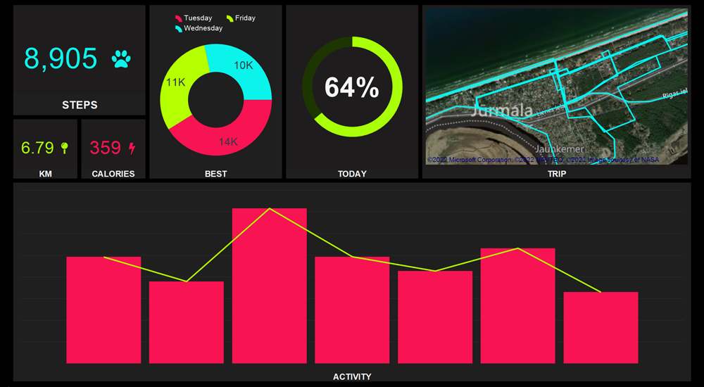
Health Activity
In addition to indicators such as:- the number of calories burned;
- the number of steps taken;
- daily activity.
This dashboard also contains a GPS navigator created using the online map. It allows you to track the route while jogging or walking and explore an area.
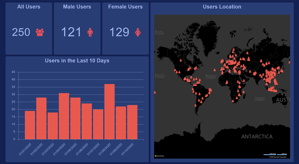
User Statistics
This dashboard allows you to know the location of your website or product users; this way, you’ll see where your main audience is located and in what countries you’re most popular. Besides, you can see who watches you more, male or female, and find out the total number of users.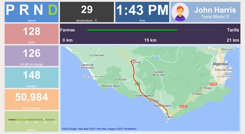
Tesla On-Board Computer
The dashboard for Tesla Model S fans is an on-board computer of the worldwide famous electric car. Here you’ll find a lot of measuring indicators - speed, temperature, time, battery charge level, etc. However, its main peculiarity was made using the Online map element – GPS navigator, which tracks and makes a route for the car and allows you to determine its current location.You can read about how to create a dashboard with the Online Map element in the documentation.
Next time we’ll tell you about the Indicator dashboard element. If you have any questions regarding this article, pleaseThis email address is being protected from spambots. You need JavaScript enabled to view it. . We will be glad to help you.
Next time we’ll tell you about the Indicator dashboard element. If you have any questions regarding this article, please